
Modellierung
-image: Gerd Gayer / Hereon-
Numerical models are required to estimate ocean state variables at times and locations for which observations are not available. Of particular importance for the COSYNA project is the ability to provide forecasts of different parameters concerning ocean waves, circulation, and suspended matter. The combination of models covering different processes and spatial scales provides a comprehensive picture of the physical and biogeochemical ocean state of the German Bight.
Circulation Model
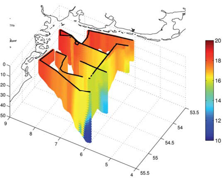
Three-dimensional distribution of water temperatures computed with a numerical model. The data are co-located with Scanfish measurements taken between 28 Juli and 5 August 2009. -image: Johannes Schulz-Stellenfleth / Hereon-
The nested-grid pre-operational circulation model consists of three model configurations: (1) Coarse-resolution outer model for the North Sea-Baltic Sea (grid size about 5 km), (2) fine-resolution inner model (grid size about 0.8 km) covering the German Bight, (3) very fine-resolution model for the Wadden Sea region (grid size about 200 m) resolving the barrier islands and the tidal flats. Although the simulation of features such as vertical stratification is very complex, the model is in good agreement with observations (figure below).
Wave Model
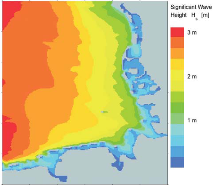
Simulated wave heights in the German Bight (21 April 2010). -image: Arno Behrens / Hereon-
The grid-nested COSYNA wave model system provides 24-hour wave forecasts twice a day on a regional scale for the North Sea and on a local scale for the German Bight. Wind fields and boundary information provided by the German Weather Service (DWD) force the forecast runs delivering a number of wave parameters such as wave height, period and direction. As example, the wave heights on 21 April, 2010 show in the German Bight at midnight (below) a typical distribution with low values at the coast and higher values off shore.
SPM Model
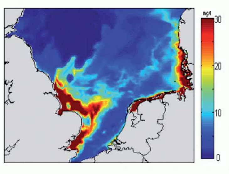
Typical distribution of modelled SPM concentrations (improved by assimilated satellite data) in mg/l at the sea surface (22 March 2003, 10:20). -image: Mikhail Dobrynin / Hereon-
The distribution of suspended particulate matter (SPM) is of primary importance for the ecological status of the sea because it impedes the daylight penetration into deeper water layers and affects the accumulation of pollutants. The model takes into account advection, vertical exchange processes due to currents and waves, sedimentation, re-suspension, and erosion at the bottom, as well as bioturbation in the sediment.
Unstructured Grid Models
Global ocean circulation models do not properly resolve shelf seas dynamics due to limitations in grid resolution and physical parameterizations. Similar to global models, regional models often poorly resolve estuarine dynamics and are rather controlled by open boundary conditions. Nested systems are not able to address the question of tracer transport from the river mouth to the open ocean or are hampered by numerical limitations. To investigate ecosystem processes in estuaries at the required high spatial resolution while avoiding the problems associated with nesting solutions COSYNA started using unstructured-mesh physical ocean models (FESOM coastal version and SCHISM) coupled to biogeochemical models
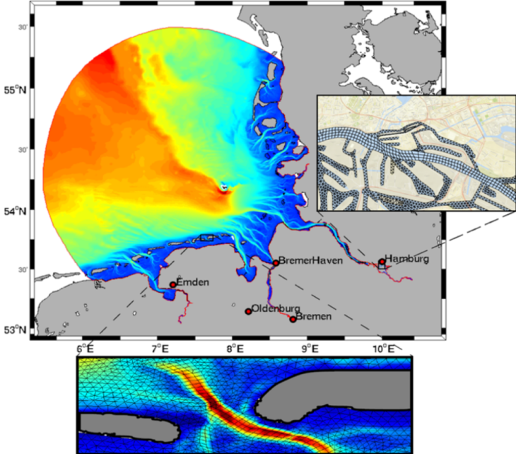
Sample salinity distribution and mesh resolution in SCHISM (Semi-implicit Cross-scale Hydroscience Integrated System Model). -image: Hereon-