Campaign Metadata Tool
A field app to standardize the collection of metadata
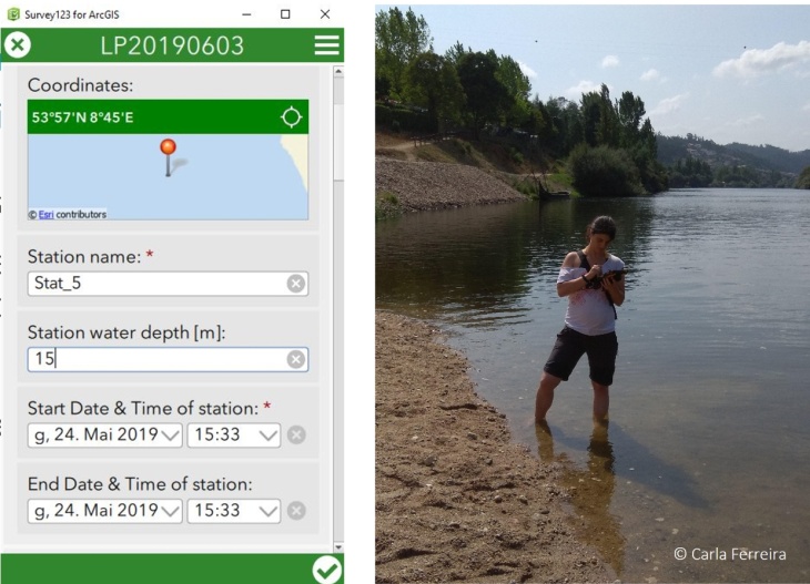
The Campaign Data Tool, developed for the Coastal Pollution Toolbox, is a customised app on a tablet that enables scientists to record relevant metadata information, such as the date and time of sampling, the involved scientists and the type of sample collected. The location is directly retrieved from a high-accuracy GNSS receiver connected to the tablet. This metadata is transmitted via mobile data transfer to the institution’s cloud storage.
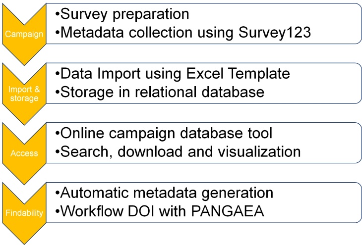
A metadata workflow offers automation of metadata for secure storage and to ensure data quality. The workflow automates and standardises the data transfer from the campaign planning stage, through sample collection in the field, analysis and quality control to the storage into databases and the publication in repositories.

From campaign planning and data generation to data repository

Example of the Campaign Planning Tool as an app and in the field (Picture by Carla Ferreira)
After the campaign, the metadata is quality checked by the field scientists and the data curator and stored in a relational database. Once the samples are analysed in the lab, the data is imported into a freely accessible database and connected to the corresponding metadata using a template. Data DOIs are registered for finalised datasets with the collaborating Data Publisher for Earth & Environmental Science PANGAEA.
Demo of Campaign Planning Tool
At pre-planning stage of a campaign, prior to operation in the field, scientists may want to share information about the campaign with partners in their institution or with partners in their projects. A digital planning tool, such as the one shown in the demo, can foster information exchange.
Please feel free to access the demo version of the Campaign Planning Tool. The demo collects campaign planning data of a network of partners. You may submit your own planned or imaginary campaigns in this interactive dashboard or see where our partners plan to head out next:

